There are many uses to which the Equation of Time has been used.
ASTRONOMICAL
Since Ptolemy's Almagest, written around 150 CE, was published, astronomers have been tabulating and using the Equation of Time - primarily for predicting lunar movement.
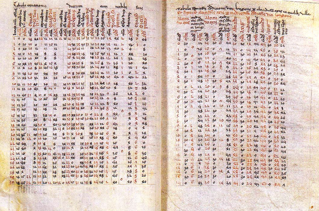
The 1493 Alfonsine Tables
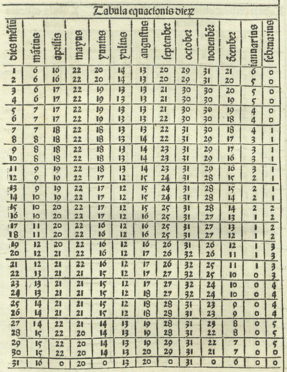
1496 Almanach Perpetuum, Abraham Zacut
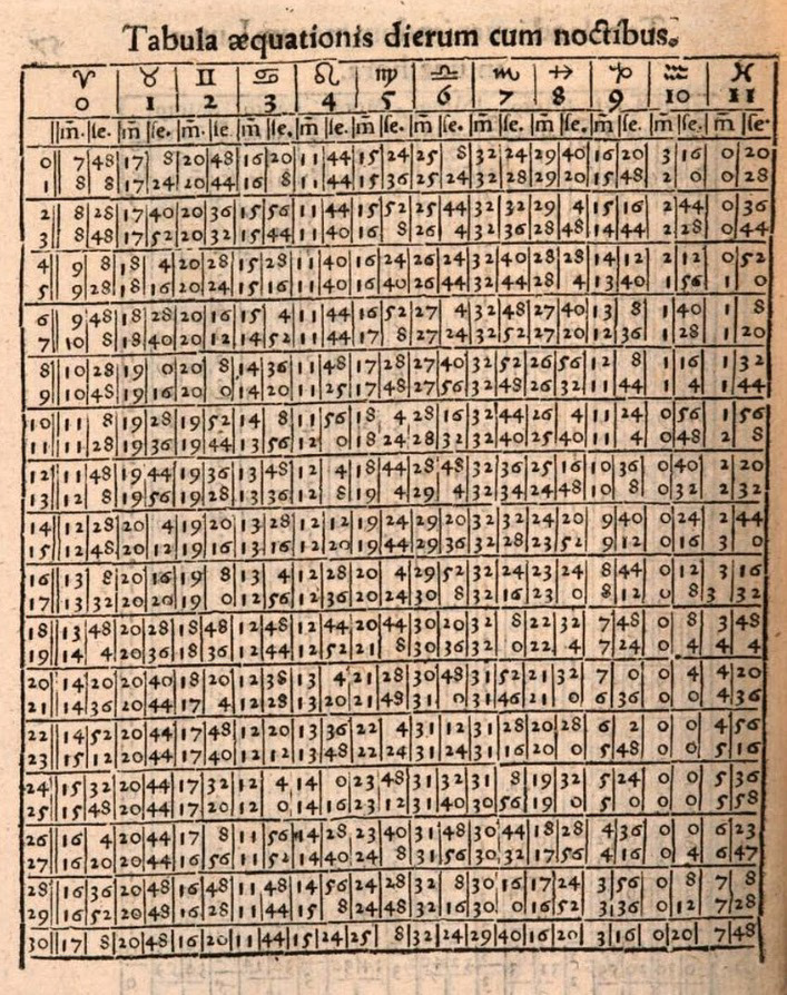
1542 The Alfonsine Tables from Tabulae resolutae de supputandis siderum motibus clarissimi mathematici by Ioannes Virdung
1496 - Epytoma Almagestum Ptolomei by Ioannis de Monte Regio (Regimontanus)
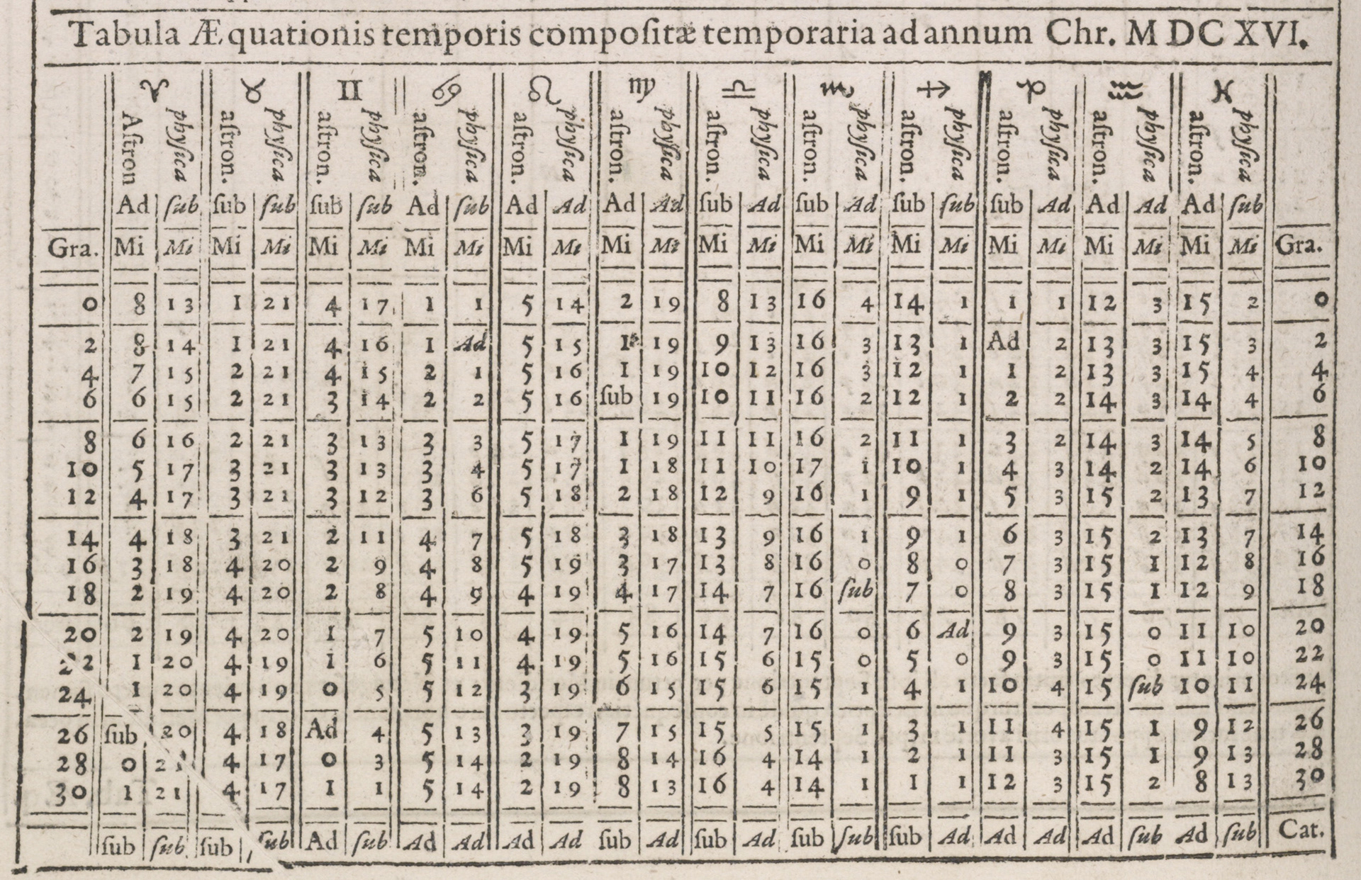
1627 The Rudolphine Tables by Joannes Kepler - The first to reflect Kepler's own Elliptical theories.
Click on images to enlarge & view captions
NAVIGATIONAL
With introduction of accurate clocks (e.g. those introduced by John Harrison in 1759) and the publication of accurate tables of the Equation of Time (e.g. those by Christian Huygens in 1673 - see below - and subsequently the Nautical Almanac 1767 and Connaissance des Temps in 1679, longitude could at last be simply calculated with sufficient precision for navigators.
It may be proper first to premise, that for all Calculations are made according to apparent Time by the Meridian of the Royal Observatory at Greenwich.
What are shown concerning the Equation of Time chiefly respects the Astronomer, the Mariner having little to do with it in computing his Longitude from the Moon's Distances from the Sun and Stars with the Help of the Ephemeris, all the Calculations therefore being adapted to apparent Time, the same which he will obtain by the Altitudes of the Sun or Stars in the Manner hereafter prescribed,
But if the Watches made upon Mr John Harrison's or other equivalent Principles should be brought into Use at Sea, the apparent Time deduced from the Altitude of the Sun must be corrected by the Equation of Time, and the mean Time found compared with that shown by the Watch, the Difference will be the Longitude in Time from the Meridian by which the Watch was set; as near as the Going of the Watch* can be depended upon. (* Going of the Watch = Accuracy)
Preface to the Nautical Almanac & Ephemeris 1st Edition 1767 by Nevil Maskelyn, Astronomer Royal
At a port of known longitude and where astronomers could measure time from the stars, the mariner would observe the firing of the noon cannon or the falling of the noon ball. At this moment, the chronometer was set to local mean time at that location. When at sea, the navigator would used his sextant to measure when the sun reached its zenith. This was 12:00 hrs Solar Noon. 12:00 + EoT was thus Local Mean Noon. The difference between Local Mean Noon at the ship and Local Mean Time at the port as shown on the chronometer was the longitudinal difference between the two places in hours. This was multiplied by 15 to give the longitudinal difference in degrees.
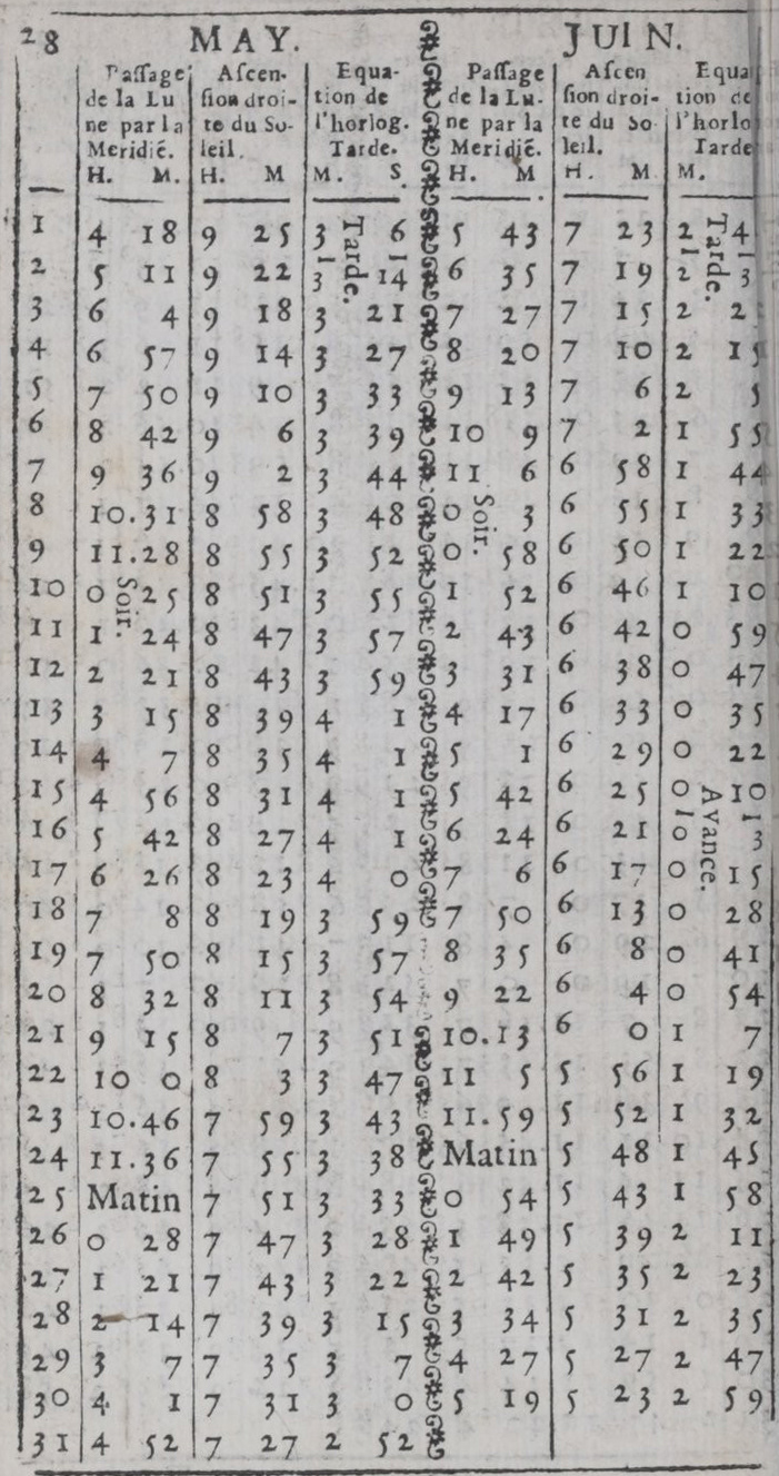
![1673 Huygens' Horologium Oscillatorium [note that days in this table for the Julian Calendar, 11 days different from the present Gregorian Calendar],](https://cdn.myportfolio.com/cf59f354b34391ef9ddbec41a1409bef/251069d7-87b5-4462-9346-8f6e5e53b535_rw_1920.jpg?h=db39f671d2e9298be001c23affb58f06)
1673 Huygens' Horologium Oscillatorium [note that days in this table for the Julian Calendar, 11 days different from the present Gregorian Calendar],
1679 Page from Connaissance des Temps : note the terminology of the third column is "Equation of the Clock"
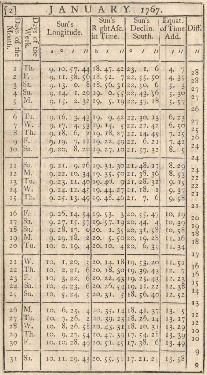
1767 Page from Nautical Almanac & Astronomical Ephemeris
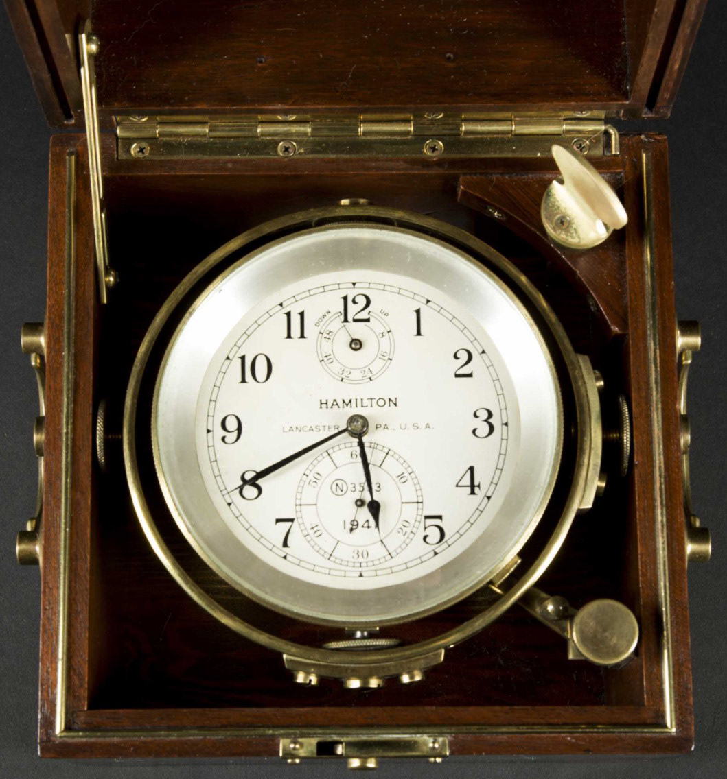
The Naval Chronometer
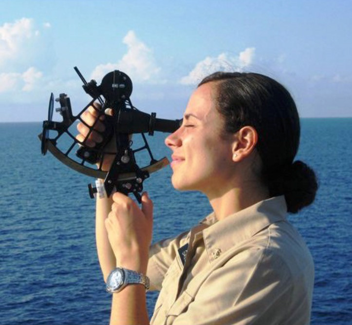
The Marine Sextant. This works by optically bringing an image of the down towards the horizon. The navigator tracks the sun until it 'bumps' the horizon - that is the moment of solar noon
Click on images to enlarge & view captions
SUN COMPASSES
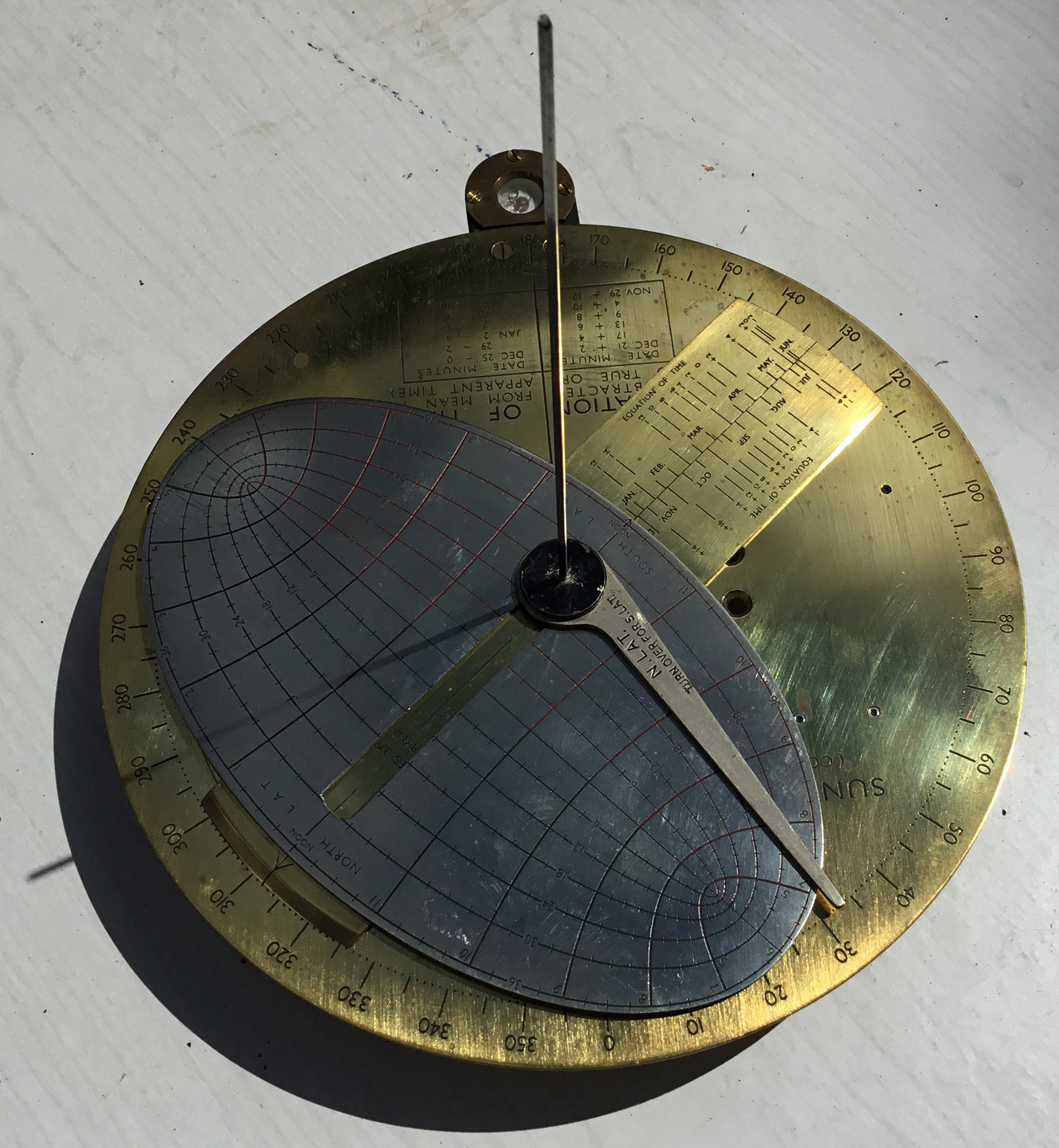
In the Second World War, Sun Compasses were developed to replace magnetic compasses in iron structured tanks & jeeps. They were used in the desert or jungles where maps were of no use. These were, in effect, stereoscopic sundials working backwards. One needed to know the time from radio broadcasts, then one could deduce the direction of North, To use, one had to have some idea of ones latitude. Two of the Sun Compasses had the Equation of Time built into their design.
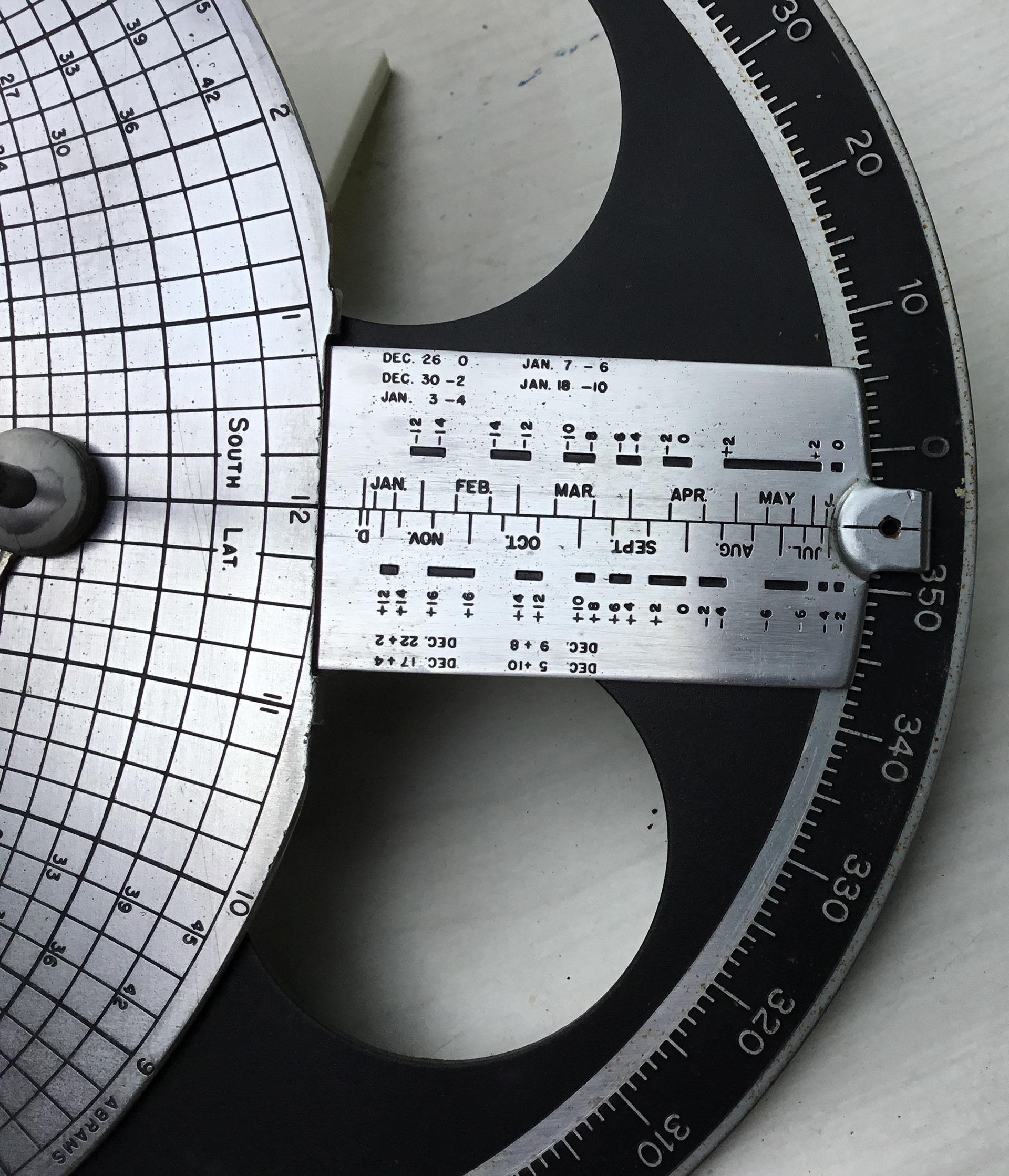
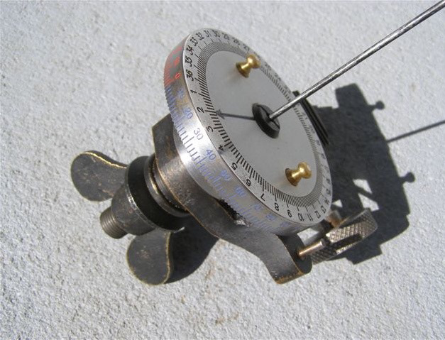
Abrams Compass, made in the US
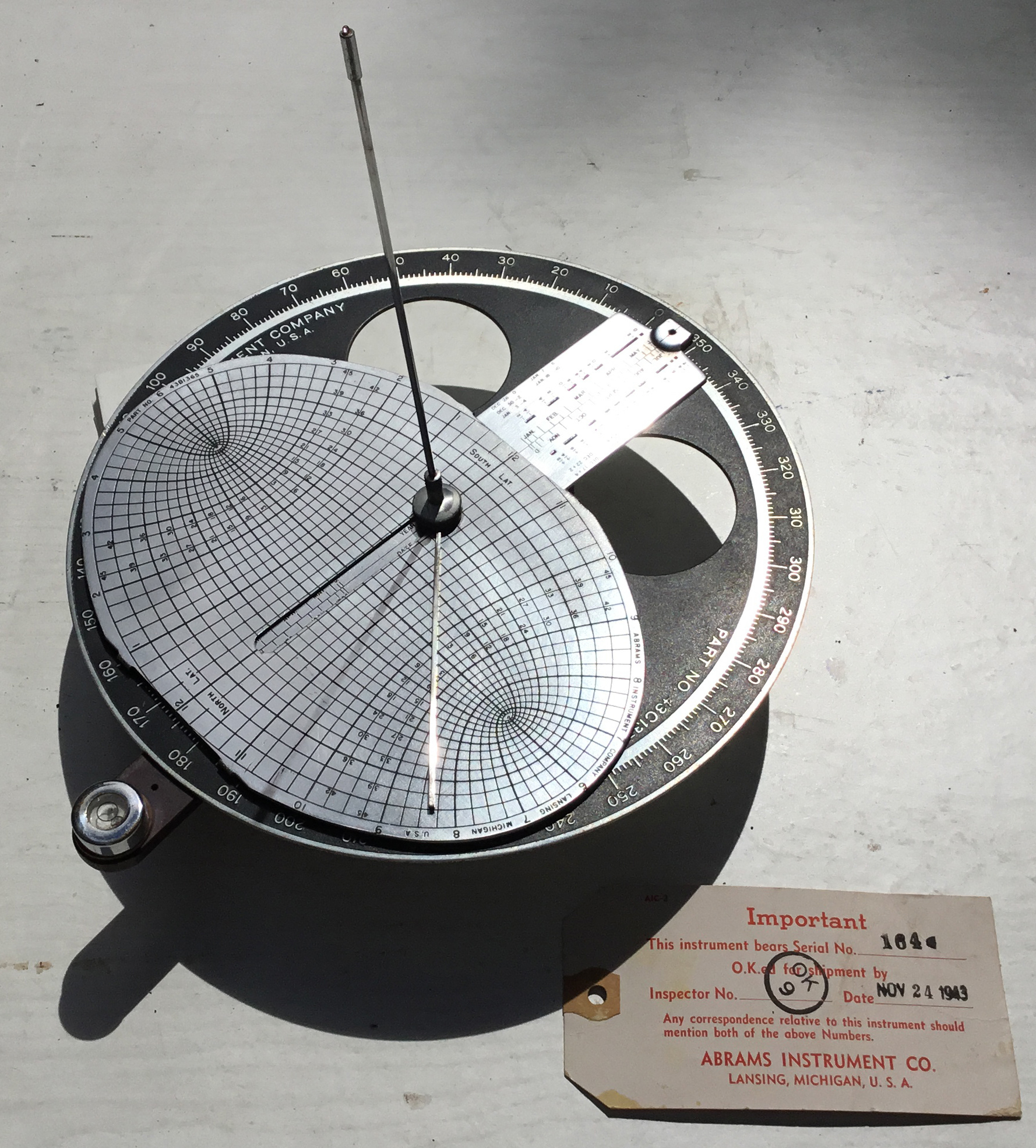
Abrams Compass, made in the US
Cole Compass, made in South Africa
Cole Compass, made in South Africa
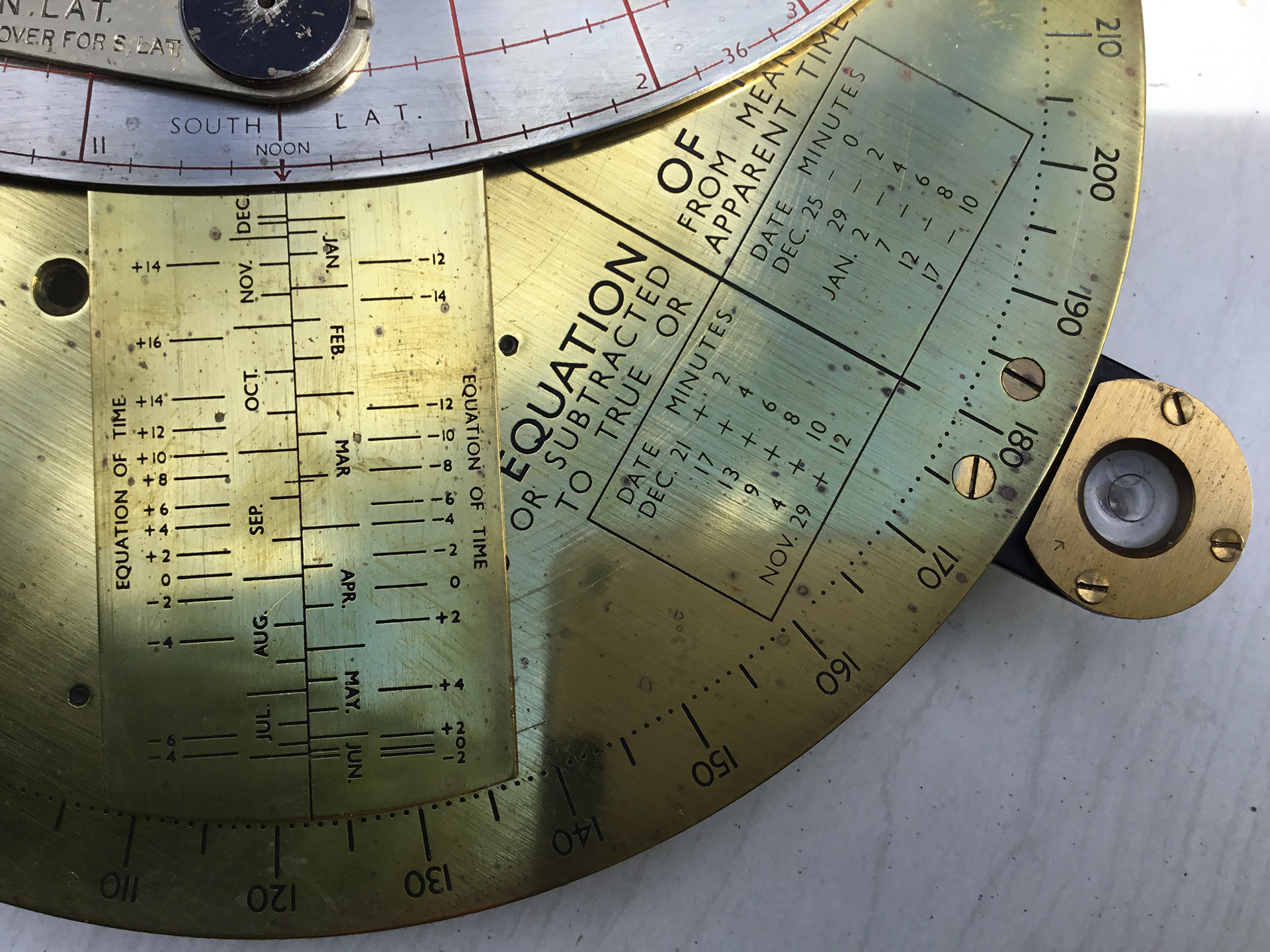
Bagnold Compass, made in the UK
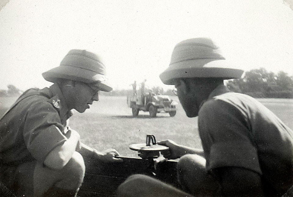
Officers training with a Compass Sun MK I
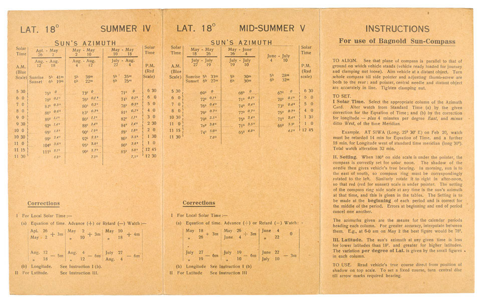
Bagnold Compass instructions with the Equation of Time

World War II - Long Range Desert Group - see the Sun Compass on dash-board of first vehicle
Click on images to enlarge & view captions
See ISBN 9783842337022 The Bagnold Sun-Compass: Long Range Desert Group by Kuno Gross - available on Amazon and see Alfonso Pastor's "The Theory behind the Sun Compasses", which is available at https://independent.academia.edu/PastorAlfonso